The Pakistan Meteorological Department’s (PMD) cyclone warning centre reported a low-pressure system that was earlier 340 km southeast of Karachi. The system has now moved over Saurashtra in Gujarat, India. It is expected to move west or southwest. It will enter the northeast Arabian Sea near the Gulf of Kutch by late Tuesday night or Wednesday morning.
Conditions such as warm sea temperatures, low to moderate wind shear, and upper-level divergence may cause the system to intensify. PMD expects it to become a depression by October 1, 2025. The system is likely to continue moving west or southwest.
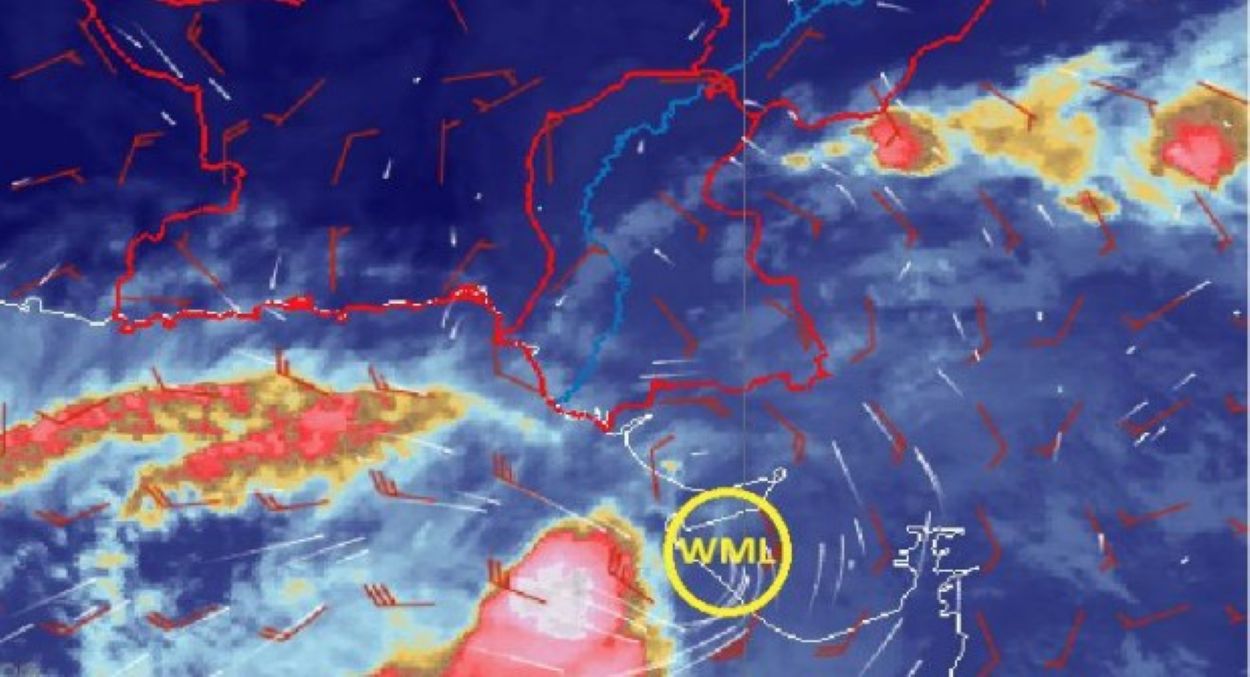
Well Marked Low-pressure Area over Saurashtra, Gujrat (India)#WeatherUpdate, #CycloneAlert, #LowPressureArea, #WeatherWarning, #KarachiWeather, #SindhWeather, #Tharparkar, #HyderabadPakistan, #KarachiRain, #Umerkot, #Badin, #Thatta, #Sujawal, #ArabianSea, #PMDUpdate pic.twitter.com/BxqsEeCJS1
— Pak Met Department محکمہ موسمیات (@pmdgov) September 30, 2025Light to moderate rain with wind and thunderstorms is forecast for September 30 and October 1. Areas affected include Tharparker, Umerkot, Sanghar, Mirpur Khas, Badin, Shaheed Benazirabad, Noshahroferoz, Hyderabad, Jamshoro, Thatta, Sujawal, Tando Muhammad Khan, Tando Allahyar, Matiari, and Karachi Division. Sea conditions will be rough to very rough, with winds of 45–55 km/hour. Fishermen in Sindh are advised to avoid deep-sea fishing until October 2.
The PMD’s cyclone centre in Karachi is closely monitoring the system and will provide updates as needed. The Met Office encourages residents to stay informed and take precautions during this period of increased weather activity.
About 15% of Pakistan’s coastal population faces the cyclone threat, according to the Pakistan Bureau of Statistics (2025). This could disrupt fishing and farming in Sindh, where 60% of residents depend on these sectors, as per FAO (2025). Timely warnings are vital to minimising risks to both the economy and people in this vulnerable region.


